


Muscoda - V 1 Voting District, Iowa County, Wisconsin
About
Outline

Summary
| Unique Area Identifier | 694043 |
| Name | Muscoda - V 1 Voting District |
| County | Iowa County |
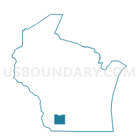
| State | Wisconsin |
| Area (square miles) | 0.41 |
| Land Area (square miles) | 0.41 |
| Water Area (square miles) | 0.00 |
| % of Land Area | 100.00 |
| % of Water Area | 0.00 |
| Latitude of the Internal Point | 43.18241770 |
| Longtitude of the Internal Point | -90.41987430 |
Maps


Graphs
Select a template below for downloading or customizing gragh for Muscoda - V 1 Voting District, Iowa County, Wisconsin


Neighbors
Neighoring Voting District (by Name) Neighboring Voting District on the Map
- Muscoda - V 1 Voting District, Grant County, WI
- Muscoda - V 2 Voting District, Grant County, WI
- PULASKI - T 1 Voting District, Iowa County, WI
Top 10 Neighboring County Subdivision (by Population) Neighboring County Subdivision on the Map
- Muscoda village, Grant County, WI (1,249)
- Pulaski town, Iowa County, WI (400)
- Muscoda village, Iowa County, WI (50)